Comparing CarryMap 3.x and CarryMap Builder capabilities
New features and improvements of the inherited functionality
CarryMap Builder is a new generation of ArcGIS Desktop extension that replaced CarryMap 3.x. This comparison outlines the main differences between CarryMap 3.х and CarryMap Builder capabilities, describes the new tools available for users in the new CarryMap Builder, and represents some improvements and changes of CarryMap 3.x functionality transferred to CarryMap Builder.
| Features | CarryMap 3.x | CarryMap Builder |
| Mobile app |
+ |
Improved |
| Creating maps for Android and iOS devices |
+ |
Improved |
| Creating maps for Windows devices |
+ |
Improved |
| Format of created maps |
CMF |
CMF2 |
| Previewing mobile map before exporting |
- |
+ |
| Selecting layers for export |
- |
+ |
| Adding text watermarks |
+ |
+ |
| Adding image watermarks |
- |
+ |
| Setting map extraction boundaries |
+ |
Improved |
| Setting map extraction boundaries by free-hand drawn polygon |
- |
+ |
| Selecting raster compression ratio | + |
Improved |
| Map protection by password |
+ |
+ |
| Map protection by availability date |
+ |
Improved |
| Map protection by IDs of devices with authorized access |
- |
+ |
| Setting objects’ identification dialogs |
+ |
Improved |
| Converting CMF maps to CMF2 |
- |
+ |
| Export to GeoPackage |
- |
+ |
| Import from GeoPackage |
- |
+ |
|
Merge CMF2 |
- |
+ |
| Extract CMF2 split by polygons |
- |
+ |
Mobile application
CarryMap Builder extension has been released with a new CarryMap mobile application for Android and iOS devices (old CarryMap Observer app is still available for download).
We’ve put a lot of efforts to solve the mobile maps formats compatibility issues (CMF vs. CMF2), as we have a lot of users using mobile maps created with the old CarryMap 3.x extension. So, with the new CarryMap app you will be able to work not only with newer CMF2 maps, but also with older CMF format (created in CarryMap 3.x).
Key features and benefits of new CarryMap app:
- faster map drawing
- data collection (points, lines, polygons), geometry and attributes editing
- support for GeoPackage file format
- recording GPS movement tracks
- adding online basemaps available in ArcGIS Online and OpenStreetMap.
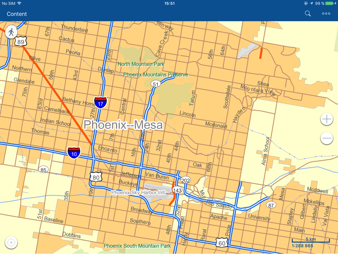
Creating mobile maps for Android and iOS devices
Unlike CarryMap 3.x extension creating mobile maps in CMF format, the new CarryMap Builder creates mobile maps in the new format – CMF2, that can be viewed with new CarryMap app for Android and iOS devices. This new format provides faster map drawing capabilities, better data compression (the output mobile maps are more compact), and the number of other advantages.
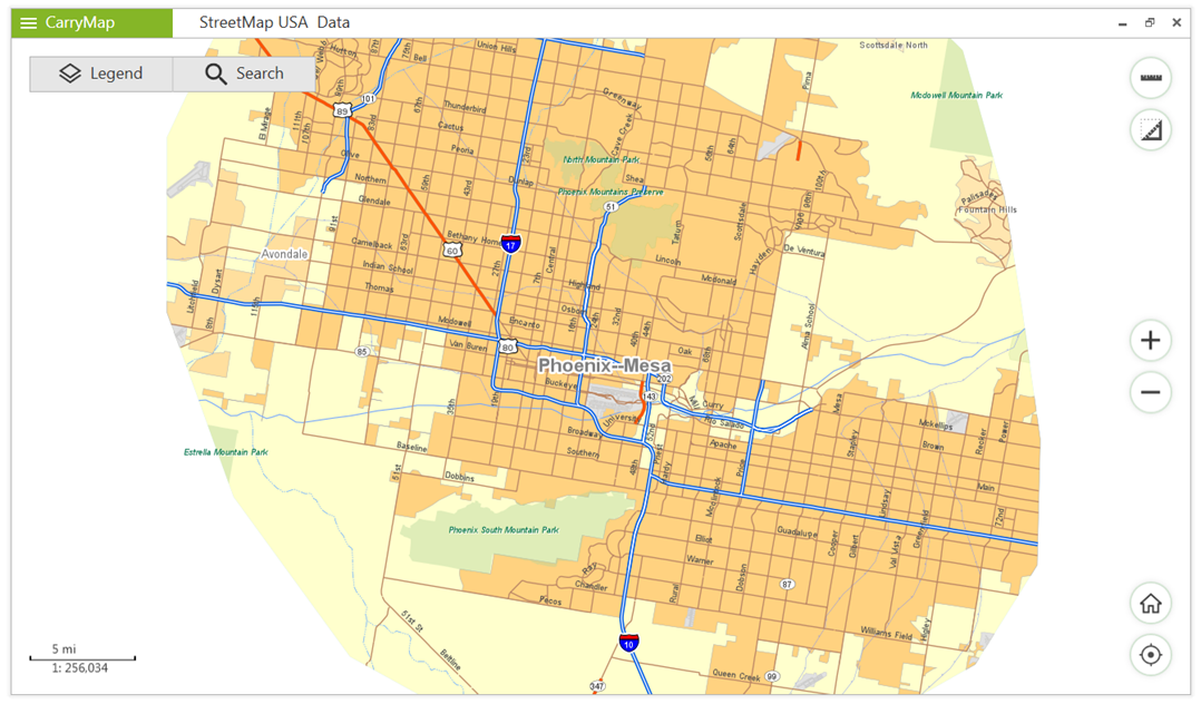
Creating mobile maps for Windows devices
CMF2 maps created with CarryMap Builder can be opened not only on Android and iOS smartphones and tablets, but also on Windows PCs with the appropriate CarryMap for Windows application.
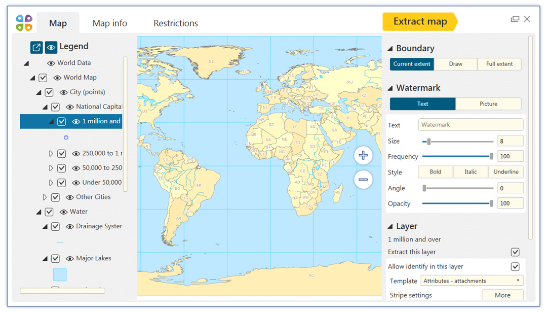
Previewing mobile map before exporting
CarryMap Builder provides users with the preview option, which allows to view the mobile map before exporting. That is, as soon as all necessary settings are specified, the preview window showing the output mobile map appears, so that you could make sure that everything looks fine or promptly make changes, if needed.
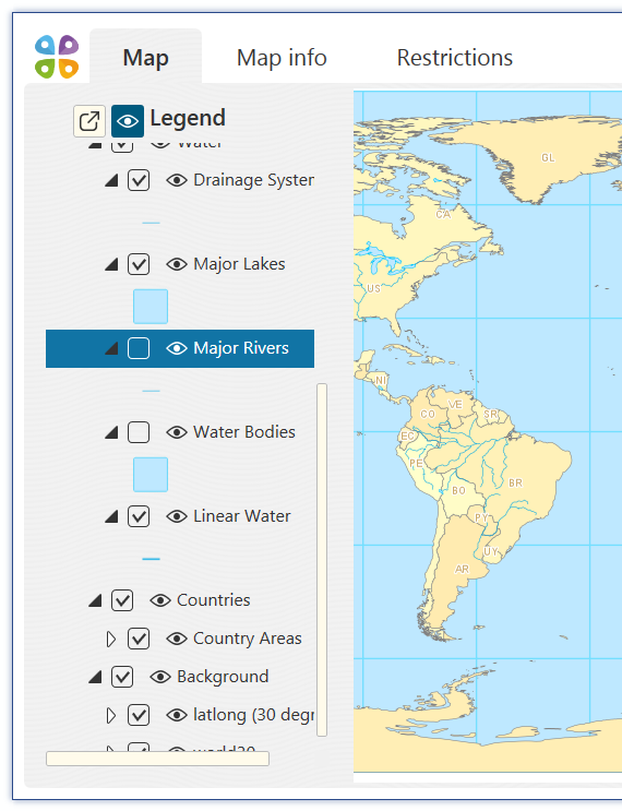
Selecting layers for export
Unlike CarryMap 3.x, the new CarryMap Builder allows to select layers from your ArcGIS map document that need to be exported to mobile map. That is, you can exclude the layers which are needed for work in in your ArcGIS map, but are not needed in the resulted mobile map used on mobile devices.
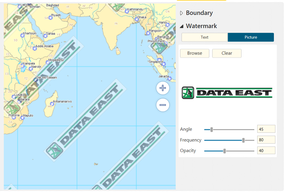
Adding image watermarks
Unlike CarryMap 3.x which allowed adding only text watermarks on the map, CarryMap Builder provides the option of adding watermarks as images as well (for example, you may want to add a company logo to the mobile map).
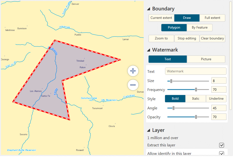
Setting map extraction boundaries
CarryMap Builder provides advanced capabilities to select the boundaries of the ArcGIS map to be exported to mobile map. In contrast to CarryMap 3.x allowing to select extraction boundaries only by current extent or by selected graphic or polygon feature, with CarryMap Builder this can be current or full map extent, selected polygon feature, or any free-hand drawn area you want to export.
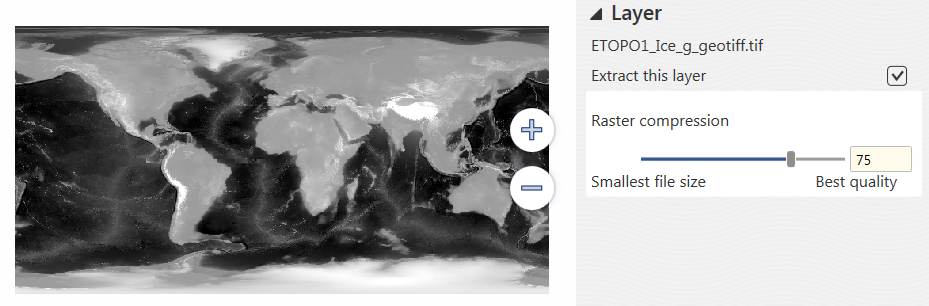
Selecting raster compression ratio
When preparing the ArcGIS map containing raster images for export to mobile map, the user can set the raster compression ratio selecting between better quality and smaller size of exported data. In contrast to CarryMap 3.x, allowing to set compression ratio for all map rasters only, CarryMap Builder provides the option to set compression ratio for each layer separately.
Map protection
CarryMap Builder provides advanced capabilities to protect your mobile maps from unauthorized access. While the map created with CarryMap 3.x could be protected with either a password or by setting the map availability period in days or the map availability end date, CarryMap Builder provides the additional option of selecting the map availability start and end dates, as well as the option to allow access for selected devices. In the latter case your map will be opened on those specific devices only, which IDs have been listed at the map protection step.
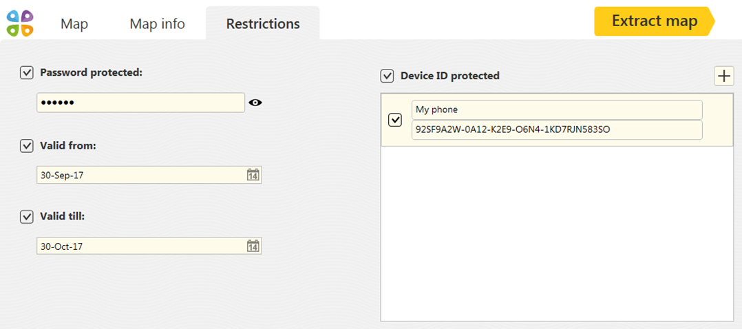
Setting objects’ identification dialogs
The known CarryMap 3.x option of setting the objects’ identification dialogs has been extended in CarryMap Builder. Now, to make your map objects as descriptive as possible you do not need to edit HTML code, just use a simple and convenient Identification templates management tool instead.
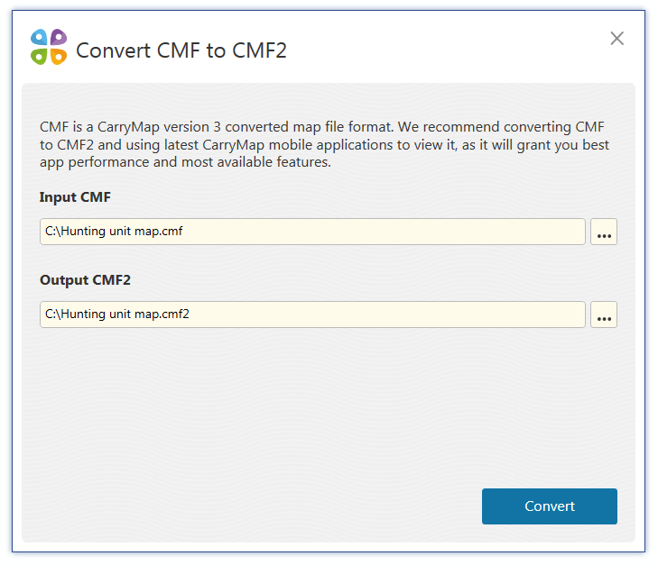
Converting CMF to CMF2 format
Users with mobile maps created with CarryMap 3.х in CMF format can convert them to the new CMF 2 format with the Convert CMF to CMF2 tool in CarryMap Builder. Having converted the old maps to newer format, you will be able to view them in the new CarryMap application and take advantage of using all the new available options for work with the mobile map on your device.
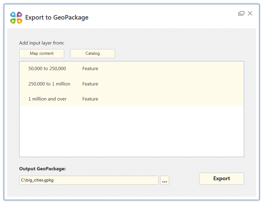
Export to GeoPackage
CarryMap Builder provides support for standard OGC GeoPackage format that allows the easy exchange of spatial data with other users inside and outside the company, as well as between separate specialists and groups of users. With the Export to GeoPackage tool you will be able to export the selected ArcGIS map layers to gpkg-file to further use it as a template for data collection in the field.
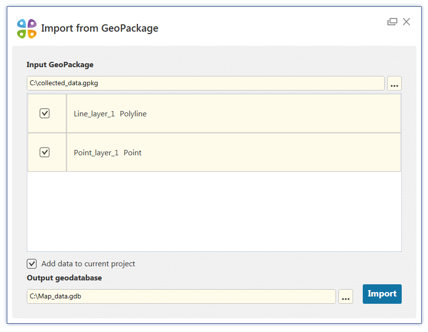
Import from GeoPackage
The data in the GeoPackage format collected in the field can be imported to the ArcGIS project with the Import from GeoPackage tool. At that you will be able to select the layers for import and the geodatabase where to they need to be saved.
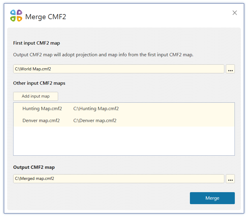
Merge CMF2
Now CarryMap Builder allows to easily combine multiple CMF2 maps to one. For example, it may be helpful when you need to create the general map of the state from several smaller maps of the counties.
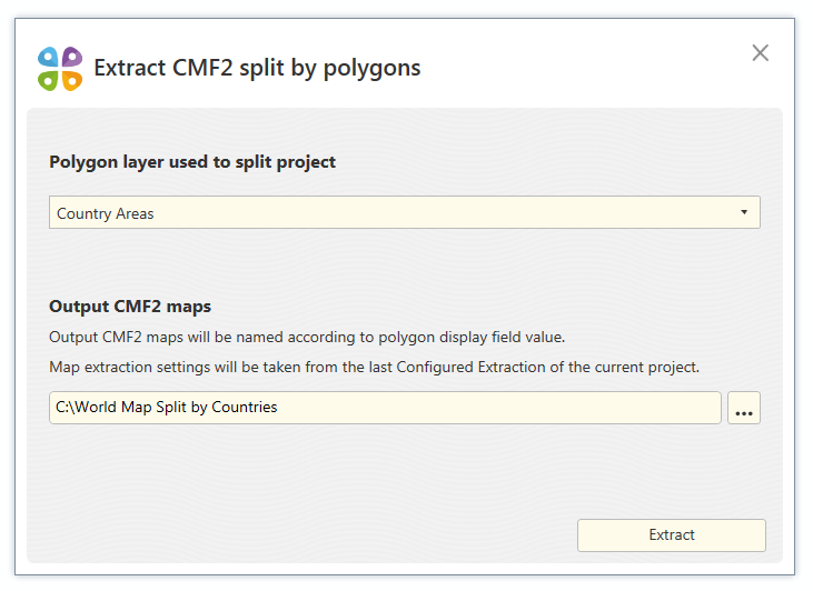
Extract CMF2 split by polygons
With this new tool available in CarryMap Builder you will be able to extract CMF2 maps in a batch mode. It may be handy if you need to create multiple mobile maps (for example, city maps from a country map or district maps from a city map) from one ArcMap map document. Just select a polygon layer that will be used as the extraction boundary for the output CMF2 maps (one polygon feature will equal one map) and run the tool.
CarryMap Team